
Fact: Only 1 in 3 Young People Can Read a Road Map.
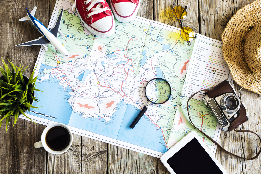
Sure, almost all of us now have GPS systems, smartphone apps, or in-car intelligence that can provide us with directions to even the most obscure destinations. But just in case, it is nice to know how to read a map. You know, the type that is printed on paper. That is impossible to re-fold and takes up valuable space in your glove-box. The kind that the gas station attendant draws on while he gives you directions.
Road maps were the only way to navigate from one destination to another before the advent of global positioning devices and smartphones. These maps were, and mostly still are, readily available at gas stations, hotel receptions and car hire desks, sometimes even for free.
Road maps, or atlases, come in many scopes, from metropolitan maps that show only a city and surrounding suburbs to atlases that show major highways and interstates for the entire country you are looking at.
The art of reading a roadmap is quite simple (much easier than parallel parking, believe me), yet many people, particularly young drivers, are not able to adequately navigate using only a paper map.
Before you review exactly how to use a road map, take into consideration the following circumstances in which the ability to read a map might be useful: your cell-phone battery dies, someone steals the GPS that you failed to store in the console while you were out shopping, your navigational device has not been updated with new roads or construction zones, you are travelling in a remote area. Many of these situations are quite probable and would leave you scrambling for directions if you did not know how to read a road map. So, here’s how it’s done:
How To Read a Road Map
1. The Index
The index lists the names of all of the cities listed on a particular map in alphabetical order and the corresponding location of each listing. The location is represented by which section of a grid system that city appears in. For example, across the bottom of a map there may be sections that are labeled A, B, C, and so on. On the left side of the map, the grids may be labeled numerically. If a town’s location is described as B4 in the index, you would look in the grid where column B and row 4 meet to find the town. When using a map to navigate, locate your current location and your destination first.
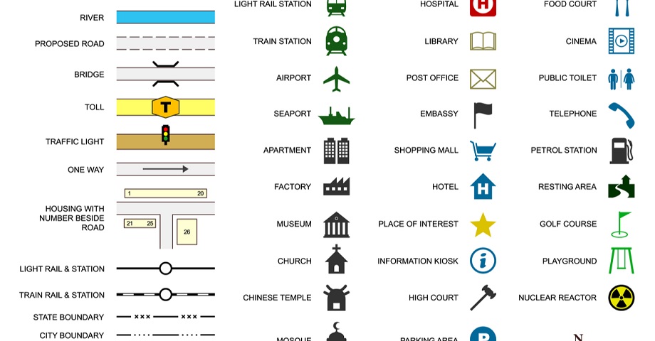
2. The Legend
Either at the bottom or on the back of a map there will appear a legend. A legend is a small box that shows examples of the types of roadways that are listed on the map. A legend will show you which color and/or style of line represents particular roadways. A general rule of thumb is that major roadways, such as highways and interstates, appear bolder on the roadmap while less significant roads, such as one lane streets in residential areas, appear fainter.
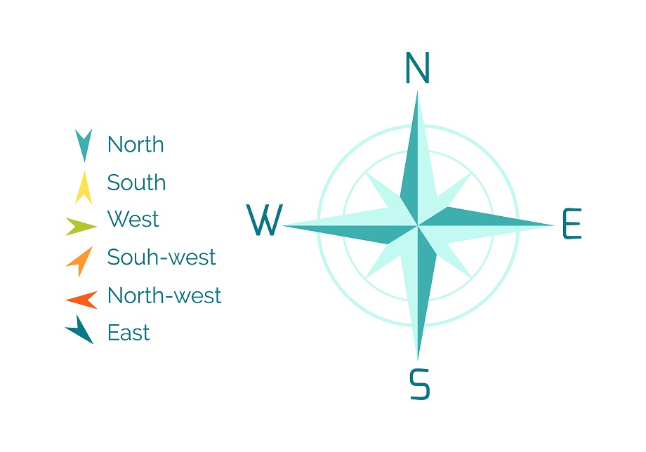
3. The Compass Rose
Almost all maps will contain a small compass rose. This may seem like ancient technology to you, but being able to turn the map in the direction you are facing may be helpful. For example, if you know that you are currently going north on a particular highway, you can use a map’s compass rose to make certain that you are following the same interstate highway on the map in a northward direction. Remember that most maps are designed with north facing up.
4. The Optimal Trip Planning
For larger trips or for travelling longer distances, it is best to look for a route that uses major highways. If you are plotting a route within a metropolitan area, remember that most city streets are oriented like a grid. One-way roads should be labeled on most city roadmaps.
5. The Scale
You can use a scale to roughly estimate the distance between one place on the map and another. The scale will probably appear somewhere close to the legend or compass rose and looks like a small line labeled with distances. You can use your finger or a small scrap of paper to measure how many times the length of the scale will fit on your chosen route. Then, multiply this number by the distance that the scale represents to approximate the actual distance.
6. The Landmarks
Many major landmarks are noted on roadmaps. As you drive, have a passenger follow your progress on the map and look for these places to ensure that your journey is going as planned.
Always keep several general roadmaps in your vehicle, particularly a metropolitan map for the area in which you live, a country roadmap for your country, and appropriate maps for routes you travel often such as vacations or trips to see your family. Also remember that road maps need to be current to be helpful. If a map is more than a couple of years old, toss it. Roadwork is a constant process and chances are good that there have been changes or additions since that map was printed.
Whether you are hopelessly lost in the middle of nowhere or planning a road trip with friends, try using a good old fashioned roadmap instead of an electronic navigational device. You might be surprised at how well it functions!
Via Driving Tests

